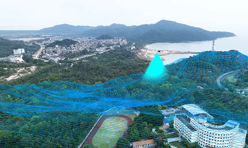
Terrain mapping just got smarter. Traditional methods take time, demand resources, and often can't reach remote or rugged areas. Enter unmanned helicopters equipped with advanced tech – the ultimate game-changers for surveying efficiency and accuracy.
Let's cut to the chase – UAVs (Unmanned Aerial Vehicles) have undeniable advantages when it comes to terrain mapping:
Speed and Efficiency: Drones cover large areas quickly. What takes days or weeks for ground crews can be done in hours.
Access to Tough Terrain: Mountain ranges? Dense forests? No problem. UAVs easily navigate areas where traditional surveyors can't.
High Accuracy and Resolution: Thanks to LiDAR sensors and high-resolution cameras, drones capture every surface detail with precision.
Cost-Effectiveness: Less time and fewer resources mean a much smaller dent in your budget.
UAVs provide faster results without sacrificing the detail engineers and planners need. It's a win-win.

Unmanned helicopters don't just fly around for the fun of it. They get serious work done:
Data Collection: UAVs equipped with advanced sensors gather extensive data on terrain features, including elevations, slopes, and vegetation.
Real-Time Analysis: The data collected can be processed on the go, offering immediate insights.
Scalable Projects: Whether it's a small survey or a vast project, drones adapt to the scope effortlessly.
Enhanced Safety: Surveyors no longer need to enter dangerous environments, reducing risk while maintaining high standards.
At ZIYAN Technology, our Ranger P2X unmanned helicopter takes terrain mapping to the next level. Here’s why it stands out:
Top-Notch Sensors: Equipped with LiDAR and high-resolution cameras, the Ranger P2X delivers precise data in any condition.
Extended Flight Time: With superior endurance, it stays in the air longer, covering more ground in a single mission.
Navigational Flexibility: Rugged terrains? Remote areas? The Ranger P2X handles them all with ease.
User-Friendly Interface: Designed for professionals, it's easy to deploy and operate, even for complex tasks.
This combination of features ensures the Ranger P2X meets the most demanding surveying needs with unmatched efficiency.
Imagine cutting down project times, increasing data accuracy, and navigating previously inaccessible areas. That's what the Ranger P2X offers. Whether you're in engineering, urban planning, or environmental studies, it's the partner you need.
Q: Can drones really replace traditional surveying methods?
A: Absolutely. While traditional methods still have their place, UAVs are faster, safer, and provide unmatched precision in complex terrains.
Q: What’s the typical range of a mapping drone?
A: It depends on the model. For instance, the Ranger P2X offers extended flight times, making it ideal for large-scale projects.
Q: Is training required to operate mapping drones?
A: Yes, but platforms like the Ranger P2X are designed to be user-friendly, minimising the learning curve.
Don't let outdated methods slow you down. Embrace the future of terrain mapping with UAVs.
Learn more about the Ranger P2X here and discover how it can transform your surveying operations today!


Small and Medium-sized UAVs
Industry-Proven UAV Solutions
Full-Customized Services
Flight Training Services
