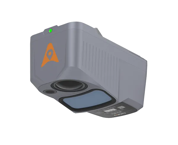
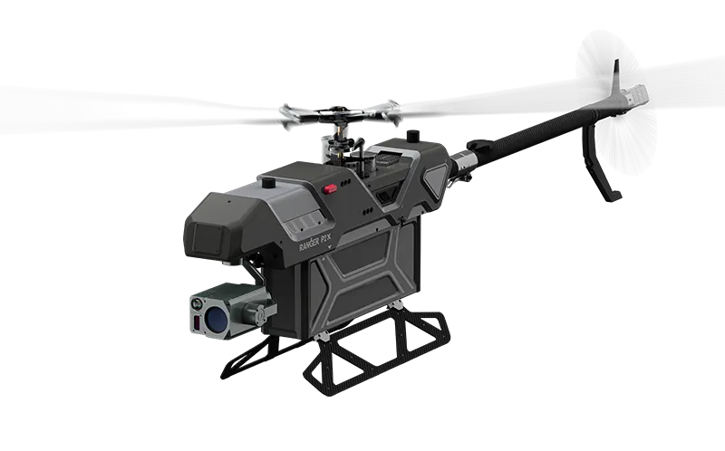
Ever wondered how drones can create precise 3D maps of landscapes, forests, or infrastructure?
That's where LiDAR comes in.
LiDAR, short for Light Detection and Ranging, is a cutting-edge remote sensing technology.
It uses laser pulses to measure distances and create highly detailed, accurate 3D models of the scanned environment.
Think of it as a supercharged laser scanner that doesn’t just capture images but also measures depth and distance in real-time.
LiDAR is revolutionizing industries like construction, agriculture, forestry, and mapping.
It's the go-to tool for detailed terrain modelling, infrastructure inspection, and even autonomous vehicle navigation.

LiDAR isn't just fancy tech—it's packed with game-changing features.
Here's why it's such a big deal:
Precision: LiDAR can measure distances to within centimetres, capturing the smallest details.
Wide Coverage: It scans vast areas quickly, providing a 360-degree view of the surroundings.
High Resolution: Produces detailed, 3D representations of objects and landscapes.
Penetration Capability: Can penetrate foliage, making it ideal for forestry or mapping under vegetation.
All-Weather Operation: Works in various lighting and weather conditions—day or night.
Efficiency: Speeds up surveys and inspections compared to traditional methods.
Versatility: Used in applications like urban planning, mining, disaster response, and more.
Safer Operations: Eliminates the need for manual inspections in dangerous or hard-to-reach areas.
In short, LiDAR is faster, smarter, and more reliable than traditional mapping and surveying tools.
Let's break it down.
LiDAR works by emitting thousands of laser pulses per second toward the ground.
Each pulse bounces back after hitting an object, and the system calculates the distance based on the time it takes for the laser to return.
This data is used to build a precise 3D map of the environment.
Here's how the process looks:
Data Collection
LiDAR sensors emit rapid laser pulses while mounted on a UAV (Unmanned Aerial Vehicle).
Processing
The returning laser signals are processed to create a detailed dataset.
Mapping
The data is converted into 3D models, highlighting terrain features, vegetation, or infrastructure.
Not all drones can handle LiDAR payloads.
But ZIYAN offers two UAV platforms that are tailor-made for LiDAR integration:
Compact and Versatile: Perfect for precision missions requiring LiDAR.
Heavy Payload Capacity: Easily supports advanced sensors like LiDAR.
Beyond Visual Line of Sight (BVLOS): Ideal for long-range data collection.
Wind Resistance: Operates smoothly even in challenging conditions.

Multi-Mission Capable: Great for applications like powerline inspections or forestry mapping.
Flexible Payload Options: Supports LiDAR and other high-performance sensors.
High Endurance: Designed for extended flights, giving you more data in less time.
Fast Deployment: Ready to fly within minutes, making it perfect for time-sensitive projects.
Both UAVs are engineered to maximise the effectiveness of LiDAR, ensuring reliable, accurate, and efficient operations.
ZIYAN Technology stands out as a leader in UAV innovation.
Their drones, like the Ranger P2X and Blow Fish A2G, are designed with industry-specific needs in mind, offering unmatched performance, durability, and flexibility.
Plus, ZIYAN ensures that their products:
Meet international quality standards.
Are customisable for unique operational requirements.
Include long-lasting, upgradable technology to reduce costs and e-waste.
LiDAR-equipped drones are used in:
Surveying and mapping
Forestry and agriculture
Infrastructure inspection (e.g., pipelines, powerlines)
Urban planning and construction
LiDAR is faster, more accurate, and versatile. It can capture complex data in less time and even operate in areas inaccessible to traditional equipment.
UAVs enhance LiDAR's capabilities by offering aerial views, faster deployment, and access to hard-to-reach locations.
ZIYAN drones are built for heavy payloads and long flights, ensuring seamless LiDAR integration for extended and precise missions.
LiDAR is changing the game in industries like mapping, inspection, and forestry.
Pairing this powerful tech with UAVs like the Ranger P2X and Blow Fish A2G unlocks unmatched efficiency and accuracy.
Whether you're surveying rugged terrains or inspecting critical infrastructure, ZIYAN's UAVs and LiDAR make the perfect team.
Want to know more? Let's talk about how ZIYAN drones can elevate your operations.


Small and Medium-sized UAVs
Industry-Proven UAV Solutions
Full-Customized Services
Flight Training Services
